Fil:Tell es-sultan.jpg
Hopp til navigering
Hopp til søk
Størrelse på denne forhåndsvisningen: 800 × 505 piksler. Andre oppløsninger: 320 × 202 piksler | 640 × 404 piksler | 1 024 × 647 piksler | 1 280 × 808 piksler | 2 995 × 1 891 piksler.
Opprinnelig fil (2 995 × 1 891 piksler, filstørrelse: 1,7 MB, MIME-type: image/jpeg)
Beskrivelse
| Beskrivelse |
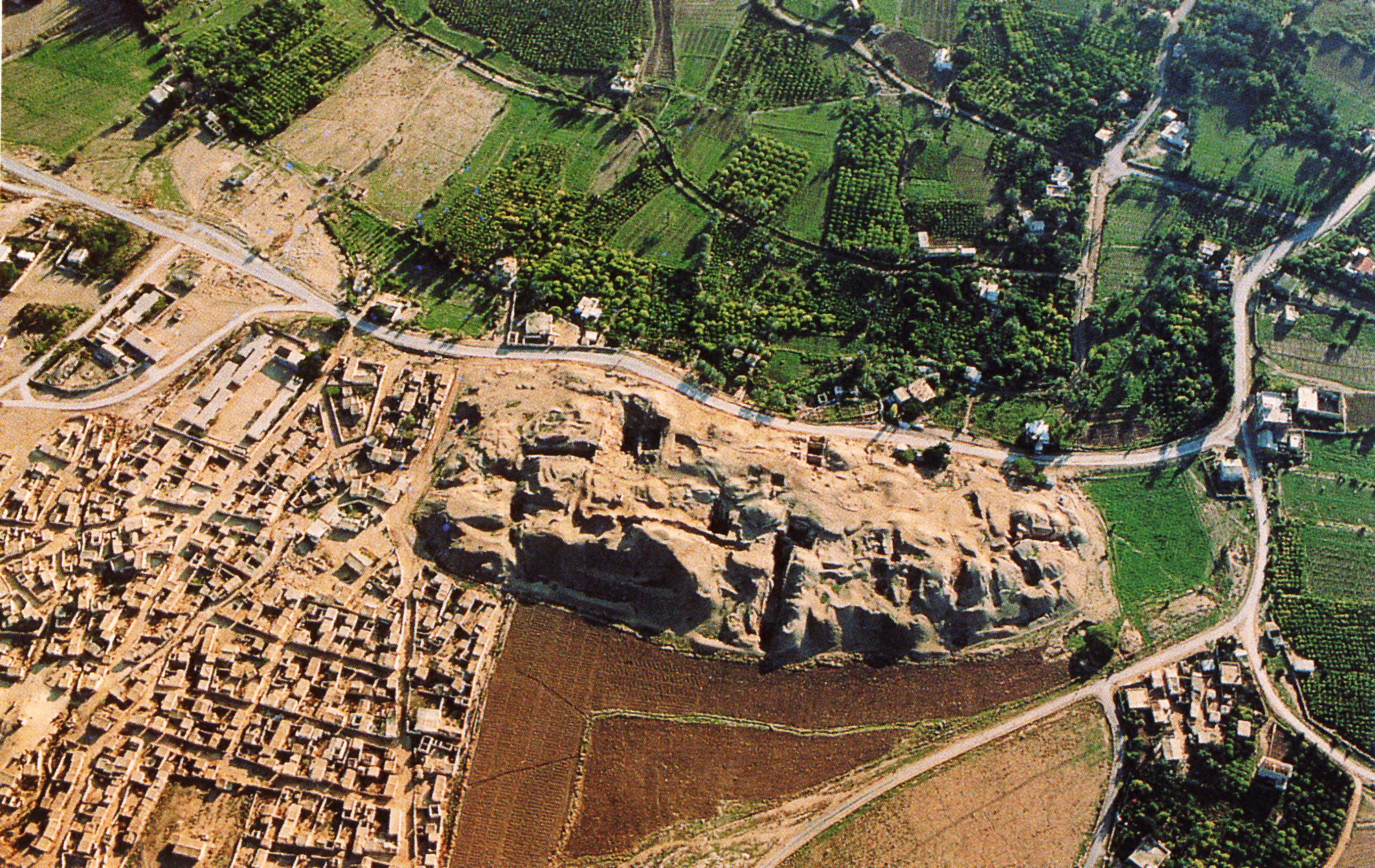
العربية: موقع تل السلطان الأثري في أريحا، فلسطين English: Aerial view of the archaeological area of Jericho, specifically showing Tell es-Sultan. The top and right parts of the image show trees, green crop fields, and other vegetation. On the bottom left of the image, you can see houses and other structures which are brown. White buildings, which are noticeably younger than than the ones on the bottom left, can be seen in the green area. Two large, uncultivated pieces of land can be seen in the middle of the bottom of the image. The top uncultivated field is dark brown, while the bottom one is sand in color. These two fields are separated by a road. Roads also run through the middle and right of the picture. The focus is a large sandy mound in the middle, which is presumably where the archeological unearthings are taking place. Italiano: veduta aerea dell'area archeologica di Gerico |
| Dato | 5. mars 2008 (original upload date) |
| Kilde | Transferred from it.wikipedia to Commons. |
| Opphavsperson | Fullo88 at italiensk Wikipedia |
Lisensiering
| Dette verket har blitt frigitt til allmennheten av opphavspersonen Fullo88 at italiensk Wikipedia. Dette gjelder på verdensbasis. I enkelte land kan dette være juridisk umulig. I så fall: Fullo88 gir hvem som helst retten til å bruke dette verket for ethvert formål, uten noen vilkår, med mindre slike vilkår kreves ved lov. |
Orginal opplastningslogg
The original description page was here. All following user names refer to it.wikipedia.
- 2008-03-05 17:11 Fullo88 3132×2016×8 (4449730 bytes) veduta aerea dell'area archeologica di Gerico
Filhistorikk
Klikk på et tidspunkt for å vise filen slik den var på det tidspunktet.
| Dato/klokkeslett | Miniatyrbilde | Dimensjoner | Bruker | Kommentar | |
|---|---|---|---|---|---|
| nåværende | 30. jan. 2017 kl. 09:09 | | 2 995 × 1 891 (1,7 MB) | wikimediacommons>Tmtriumph | Rasterung verringert |
Filbruk
Den følgende siden bruker denne filen: