Denne filen er fra Wikimedia Commons og kan brukes av andre prosjekter.
Beskrivelsen fra filbeskrivelsessida vises nedenfor.
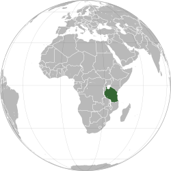
This is a Grey & green orthographic projection map.
World maps
Africa
Burundi
Comoros
Djibouti
Eritrea
Ethiopia
Kenya
Madagascar
Malawi
Mauritius
Mayotte
Mozambique
Tanzania
Somalia
Uganda
Lesotho
South Africa
Zambia
Zimbabwe
Angola
Cameroon
Central African Republic
Chad
Republic of the Congo
Democratic Republic of the Congo
Gabon
South Sudan
Algeria
Egypt
Libya
Morocco
Morocco & Western Sahara
Sahrawri Arab Democratic Republic
Sudan
Tunisia
Western Sahara
Azawad
Benin
Burkina Faso
Cape Verde
Côte d'Ivoire
Gambia
Ghana
Guinea
Liberia
Mali
Mali without Azawad
Mauritania
Niger
Nigeria
Senegal
Sierra Leone
Greenland
Canada
United States of America
Mexico
Guatemala
El Salvador
Honduras
Nicaragua
Costa Rica
Panama
Trinidad and Tobago
Cuba
Dominican Republic
Haiti
Jamaica
Argentina
Bolivia
Brazil
Chile
Colombia
Ecuador
French Guiana
Guyana
Paraguay
Peru
Suriname
Uruguay
Venezuela (excluding claimed)
Venezuela (including claimed)
"Asia (orthographic projection).svg", frequently subject to lame edit wars over the Caucasus boundary
East Asia
China
Japan
Mongolia
North Korea (excluding claimed)
South Korea (excluding claimed)
Jiangxi
Taiwan
Republic of China (including claimed)
Republic of China (enlargement of Taiwan)
Republic of Korea (including claimed)
Democratic People's Republic of Korea (including claimed)
Korea
Central Asia
Kazakhstan
Tajikistan
Kyrgyzstan
Uzbekistan
Southeast Asia
Association of Southeast Asian Nations
The Philippines and ASEAN
Indonesia
Malaysia
Philippines
Thailand
South Asia
Afghanistan
Bangladesh
Bhutan
India
Maldives
Nepal
Pakistan
Sri Lanka
Western Asia
Levant
Georgia
Georgia (with inset), showing breakaway states
Georgia (with inset), without breakaway states
Armenia
Azerbaijan
Nagorno-Karabakh Republic
Iran
Iraq
Israel
Jordan
Saudi Arabia
State of Palestine
Syria
Lebanon
Turkey
United Arab Emirates
Europe, Caucasus-Urals boundary
Europe, unclear boundary somewhere in the mid-Caucasus, suffering from edit-wars
Europe, Caucasus-Urals boundary, with state borders
Northern Europe
Southern Europe
Western Europe
Northwestern Europe
Mainland Europe
Latin Europe
Council of Europe
European Union
European Union with internal borders
Benelux
Visegrád Group
British Isles
Great Britain
Island of Cyprus
Iberia
Albania
Armenia
Azerbaijan
Belarus
Belgium
Bosnia and Herzegovina
Bulgaria
Republic of Cyprus
Czech Republic
Denmark
Finland
France
Georgia
Georgia (with inset), showing breakaway states
Georgia (with inset), without breakaway states
Germany
Iceland
Italy
Kazakhstan
Kosovo
North Macedonia
Montenegro
Netherlands
Norway
Northern Cyprus
Poland
Portugal
Romania
Russia
Serbia
Spain
Sweden
Switzerland
Turkey
United Kingdom
Oceania
Australia-New Guinea
Australia
Fiji
New Zealand
Papua New Guinea
The Americas
Afro-eurasia
Arctic
Antarctica
Kingdom of the Netherlands
Organization for Security and Co-operation in Europe
Eurasia
Eurasian Economic Union
Greater Middle East
Ibero-America
Middle East
North Atlantic Treaty Organization
Arab World
Arab League
Latin America
Anglo America
Franco America
Hispanic America
Shanghai Cooperation Organization
Almoravid Empire
Austro-Hungary
Aztec Empire
Aztec Empire (with dominance between Teozapotlan and Xoconochco)
Biafra
Benin (Separatist state in Nigeria)
Captaincy General of Chile
Chincha Country
Confederate States of America
Dominion of Pakistan (with Indian Controlled Kashmir)
Eurasian Economic Community
European Economic Community
Empire of Brazil
Federal Republic of Central America
First Mexican Empire
Frankish Empire
German Reich
German Reich (With Occupations)
Great Colombia
Granadine Confederation
Italian Empire
Japanese Empire
Inca Empire
Mughal Empire
New France
New Granada
Peru–Bolivia Confederation
Roman Empire
Russian Empire
Second Mexican Empire
Songhai Empire
Union of Soviet Socialist Republics
United Arab Republic
United Provinces of Central America
United States of Colombia
Viceroyalty of New Granada
Viceroyalty of New Spain
Viceroyalty of Peru
Viceroyalty of the Río de la Plata
Wilsonian Armenia
Canary Islands, Spain
Catalan Countries
French Guiana
Greenland
Québec, Canada
Puerto Rico, U.S.
Great Britain
Dagestan (Federal subject of Russia)
norsk bokmål Legg til en kort forklaring på hva filen representerer
engelsk Tanzania (orthographic projection)
gresk Η χώρα της Τανζανίας στόν χάρτη της Αφρικής
fransk Globe terrestre avec la Tanzanie en vert.
Filhistorikk
Klikk på et tidspunkt for å vise filen slik den var på det tidspunktet.
Dato/klokkeslett Miniatyrbilde Dimensjoner Bruker Kommentar nåværende 30. mar. 2025 kl. 18:52 600 × 600 (559 KB) wikimediacommons>M.Bitton Cleaner version of the stable map
Filbruk
Den følgende siden bruker denne filen:
Denne filen inneholder tilleggsinformasjon, sannsynligvis lagt til av digitalkameraet eller skanneren som ble brukt til å lage eller digitalisere det.
Hvis filen har blitt forandret fra utgangspunktet, kan enkelte detaljer være unøyaktige.

.svg)
.svg)
.svg)
.svg)
.svg)
.svg)
.svg)
.svg)
.svg)
.svg)
.svg)
.svg)
.svg)
.svg)
.svg)
.svg)
.svg)
.svg)
.svg)
.svg)
.svg)
.svg)
.svg)
.svg)
.svg)
.svg)
.svg)
.svg)
.svg)
.svg)
.svg)
.svg)
.svg)
.svg)
.svg)
.svg)
.svg)
.svg)
.svg)
.svg)
.svg)
.svg)
.svg)
.svg)
.svg)
.svg)
.svg)
.svg)
.svg)
.svg)
.svg)
.svg)
.svg)
.svg)
.svg)
.svg)
.svg)
.svg)

.svg)
.svg)
.svg)
.svg)
.svg)
.svg)
.svg)
.svg)
.svg)
.svg)
.svg)
.svg)
.svg)
.svg)
.svg)
.svg)
.svg)
.svg)
.svg)
.svg)
.svg)


.svg)
.svg)
.svg)
.svg)
.svg)
.svg)
.svg)

.svg)
.svg)
.svg)
.svg)
.svg)
.svg)
.svg)
.svg)
.svg)
.svg)

.svg)
.svg)
.svg)
.svg)
.svg)
.svg)
.svg)
_without_national_boundaries.svg)
.svg)
.svg)
.svg)
.svg)
.svg)
.svg)

.svg)
.svg)
.png)
.svg)
.svg)
.svg)
.svg)

.svg)
.svg)
.svg)
.svg)
.svg)
.svg)
.svg)
.svg)
.svg)
.svg)
.svg)

.svg)
.svg)
.svg)
.svg)
.svg)
.svg)
.svg)
.svg)
.svg)

.svg)
.svg)

.svg)
.svg)
.svg)
.svg)
.svg)
.svg)
.svg)
.svg)
.svg)
.svg)
.svg)
.svg)
.svg)
.svg)
.svg)
.svg)
.svg)
.svg)
.svg)
.svg)
.svg)
.svg)
.svg)
.svg)
.svg)
.svg)
.svg)
_-_Crimea_disputed.svg)
.svg)
.svg)
.svg)
.svg)
.svg)
.svg)
.svg)
.svg)
.svg)
.svg)
.svg)
.svg)
_political.svg)
.svg)
.svg)
.svg)
.svg)
_-_Crimea_disputed_-_no_borders.svg)
.svg)
.svg)
.svg)
.svg)
.svg)
.svg)
.svg)
.svg)
.svg)
.svg)
.svg)

.svg)
.svg)
.svg)

.png)
.svg)
.svg)
.svg)
.svg)
.svg)
.svg)
.svg)
.svg)
.svg)
.svg)
.svg)
.svg)
.svg)
.svg)
.svg)
.svg)
.svg)
.svg)
.svg)
.svg)
.svg)
.svg)
.svg)
.svg)
.svg)
.svg)
.svg)
.svg)
.svg)
.svg)
.svg)
.svg)
.svg)
.svg)
.png)
.svg)
.svg)
.svg)
_(orthographic_projection).png)
.svg)
.svg)
.svg)