Fil:Near east lrg.jpg
Hopp til navigering
Hopp til søk

Størrelse på denne forhåndsvisningen: 451 × 599 piksler. Andre oppløsninger: 181 × 240 piksler | 361 × 480 piksler | 578 × 768 piksler | 771 × 1 024 piksler | 1 542 × 2 048 piksler | 2 987 × 3 967 piksler.
Opprinnelig fil (2 987 × 3 967 piksler, filstørrelse: 2,62 MB, MIME-type: image/jpeg)
| Beskrivelse |
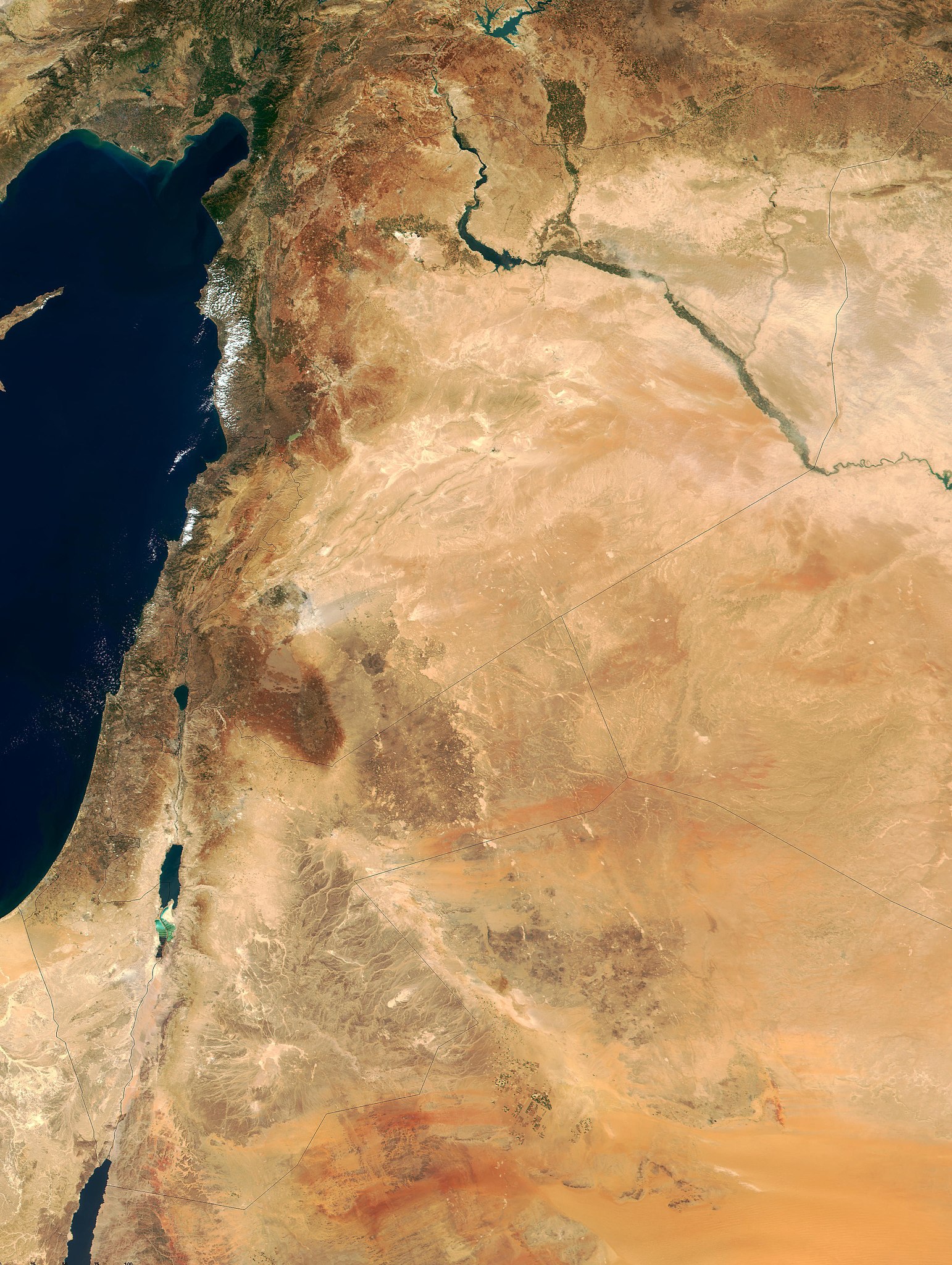
This true-color image of the region was taken on September 10, 2000, by the MODerate-resolution Imaging Spectroradiometer (MODIS) flying aboard NASA's Terra spacecraft. The image shows the lands of Israel along the eastern shore of the Mediterranean Sea, with the countries of Jordan to the southeast and Syria to the Northeast. The region known as the West Bank lies between the two countries. Running from north to south, the Jordan River links the Sea of Galilee to the Dead Sea. Click the image to enlarge it, and to see the borders drawn in. Image courtesy Jacques Descloitres, MODIS Land Group, NASA GSFC |
| Dato | image taken on 10. Sep. 2000 |
| Kilde | http://earthobservatory.nasa.gov/Newsroom/NewImages/Images/modis_near_east_lrg.jpg |
| Opphavsperson | NASA, earthobservatory, http://earthobservatory.nasa.gov/ |
| Tillatelse (Gjenbruk av denne filen) |
PD-USGov-NASA |
| This file is in the public domain in the United States because it was solely created by NASA. NASA copyright policy states that "NASA material is not protected by copyright unless noted". (See Template:PD-USGov, NASA copyright policy page or JPL Image Use Policy.) | ||
 |
Warnings:
|
Filhistorikk
Klikk på et tidspunkt for å vise filen slik den var på det tidspunktet.
| Dato/klokkeslett | Miniatyrbilde | Dimensjoner | Bruker | Kommentar | |
|---|---|---|---|---|---|
| nåværende | 5. feb. 2015 kl. 22:27 | | 2 987 × 3 967 (2,62 MB) | wikimediacommons>Capricorn4049 | Cropped < 1 % horizontally and 1 % vertically using CropTool with precise mode. |
Filbruk
De følgende 2 sidene bruker denne filen: