Fil:French and Indian War map.png
Hopp til navigering
Hopp til søk
Størrelse på denne forhåndsvisningen: 561 × 599 piksler. Andre oppløsninger: 225 × 240 piksler | 449 × 480 piksler | 719 × 768 piksler | 958 × 1 024 piksler | 2 128 × 2 274 piksler.
Opprinnelig fil (2 128 × 2 274 piksler, filstørrelse: 858 KB, MIME-type: image/png)
Beskrivelse
| Beskrivelse |
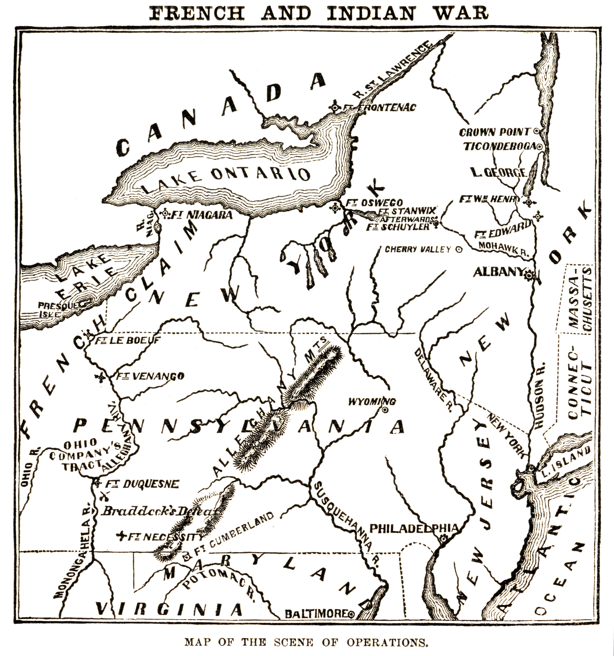
English: Map of the "scene of operations" of the en:French and Indian War. |
| Kilde | Harper's Encyclopedia of United States History, Harper & Brothers, 1905. |
| Opphavsperson | Harper & Brothers |
Lisensiering
This media file is in the public domain in the United States. This applies to U.S. works where the copyright has expired, often because its first publication occurred prior to January 1, 1930, and if not then due to lack of notice or renewal. See this page for further explanation.
|
 | |
 |
Orginal opplastningslogg
The original description page was here. All following user names refer to en.wikipedia.
- 2006-05-02 01:31 Nonenmac 2128×2274×8 (878312 bytes) Map of the "scene of operations" of the [[French and Indian War]]. {{Harper's Encyclopedia of US History}}
Filhistorikk
Klikk på et tidspunkt for å vise filen slik den var på det tidspunktet.
| Dato/klokkeslett | Miniatyrbilde | Dimensjoner | Bruker | Kommentar | |
|---|---|---|---|---|---|
| nåværende | 5. jan. 2008 kl. 23:31 | | 2 128 × 2 274 (858 KB) | wikimediacommons>Tomia | full resolution from en: |
Filbruk
Den følgende siden bruker denne filen: