Fil:Arabian Peninsula dust SeaWiFS.jpg
Hopp til navigering
Hopp til søk

Størrelse på denne forhåndsvisningen: 657 × 600 piksler. Andre oppløsninger: 263 × 240 piksler | 526 × 480 piksler | 841 × 768 piksler | 1 122 × 1 024 piksler | 2 504 × 2 286 piksler.
Opprinnelig fil (2 504 × 2 286 piksler, filstørrelse: 853 KB, MIME-type: image/jpeg)
| Beskrivelse |
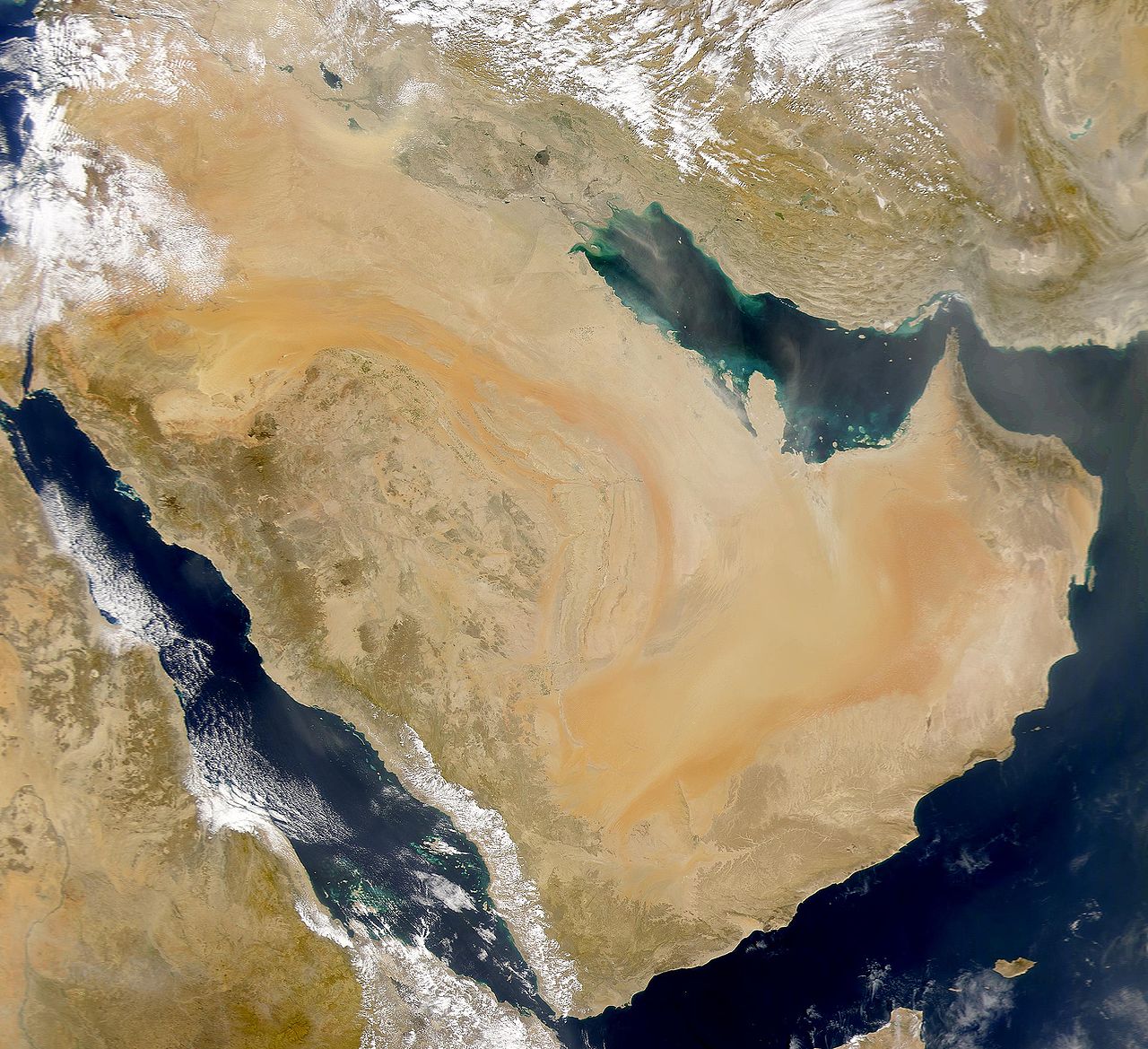
English: SeaWiFS collected this view of Arabia and of dust blowing across the Persian Gulf.
Español: La Península Arábiga vista desde el espacio |
| Dato | Tatt den 2. mars 2000 |
| Kilde | http://visibleearth.nasa.gov/view_rec.php?id=898 |
| Opphavsperson | SeaWiFS Project, NASA/Goddard Space Flight Center, and ORBIMAGE |
| Andre versjoner |
Derivative works of this file: |
| This image is from the Sea-viewing Wide Field-of-view Sensor (SeaWiFS) Project and more than 5 years old.
Satellite data captured by the SeaWIFS sensor are released into the public domain 5 years after capture. Data less than five years old can be re-used only for educational or scientific purposes; any commercial use of such images must be coordinated with GeoEye. [1] |
| This work has been released into the public domain by its copyright holder, GeoEye. This applies worldwide. I enkelte land kan dette være juridisk umulig. I så fall: GeoEye gir hvem som helst retten til å bruke dette verket for ethvert formål, uten noen vilkår, med mindre slike vilkår kreves ved lov.
|
Orginal opplastningslogg
The original description page was here. All following user names refer to commons.wikimedia.
- 2007-12-17 19:34 Hautala 2,504×2,286 (853000 bytes) {{PD-USGov-NASA}} Taken from NASA's Visible Earth, http://visibleearth.nasa.gov/
Filhistorikk
Klikk på et tidspunkt for å vise filen slik den var på det tidspunktet.
| Dato/klokkeslett | Miniatyrbilde | Dimensjoner | Bruker | Kommentar | |
|---|---|---|---|---|---|
| nåværende | 2. jan. 2008 kl. 17:02 | | 2 504 × 2 286 (853 KB) | wikimediacommons>Hautala | {{PD-USGov-NASA}} * {{en|Satellite image of Arabian peninsula}} * {{es|La Península Arábiga vista desde el espacio}} * {{en|Satelliittikuva Arabian niemimaasta}} Taken from NASA's [http://visibleearth.nasa.gov/ Visible Earth], from the page [http://v |
Filbruk
Det er ingen sider som bruker denne filen.